|
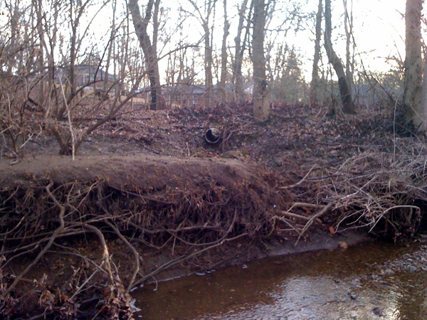
Laclede Gas
Shrewsbury Yard Stream Bank and Storm Sewer Improvements St. Louis Housing Authority
Exterior Renovation & Modernization Tiffany Apartments – Complete Site Renovation
MSD CC-17 Four Season Branch Sanitary Relief Phase II
St. Louis County
Emergency Communications Center Ohlendorf Park West
Jefferson County - Old Antonia Bridge Replacement
City of Clayton – The Historic Martin Franklin Hanley House
Wise and Mabel Sewer Separation
MSD Fawnvalley Storm Channel Improvements
Topographic & Strip Map Surveying and Easement Preparation
35-Acre Union Pacific Property in City Block 3417
ALTA/ASCM Land Title Survey
Powerhouse and Grand Central Parcels of St. Louis Union Station
ALTA/ASCM Land Title Surveys
St. Louis Loop Trolley Project
Property/Right-of-Way and Topographic Surveying
City of Kirkwood – Farmers Market Park
Property/Right-of-Way and Topographic Surveying Services for Sidewalk, Planting, Grading and Drainage Improvements
|
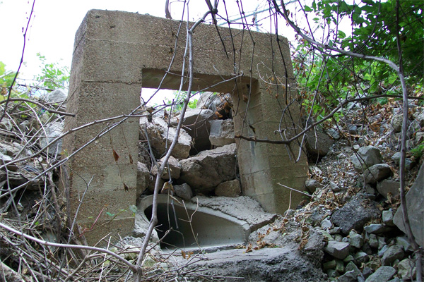
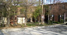
Laclede Gas
Shrewsbury Yard Stream Bank and Storm Sewer Improvements |
|
Click photo to enlarge |
CLIENT
Laclede Gas
LOCATION
Kirkwood, MO |
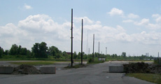
Pangea Engineering and Surveying, LLC is employed to provide surveying and civil engineering design services for the 550-feet of stream bank and storm channel improvements associated with the extension of an existing 66-inch storm sewer that discharges into a large creek that traverses through the Laclede Gas Company’s – Shrewsbury Yard to its confluence with Deer Creek. Due to changes in the topography and improvements to the areas adjacent to the banks, the creek is in a critical erosive state and is presently downcutting to such a degree that an existing 7-horseshoe shaped concrete combined sewer is now exposed in the bottom of the creek. Pangea provided detailed Topographic, and property Strip Map Surveying Services for this project in extremely difficult terrain within the City of Shrewsbury Kirkwood, Missouri.
Pangea is performing the civil engineering design of the storm sewer extension as well as environmentally sensitive improvements for creek bank and channel bottom improvements from the end of the storm sewer to the confluence with Deer Creek.
back to top |
|
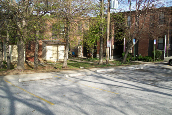
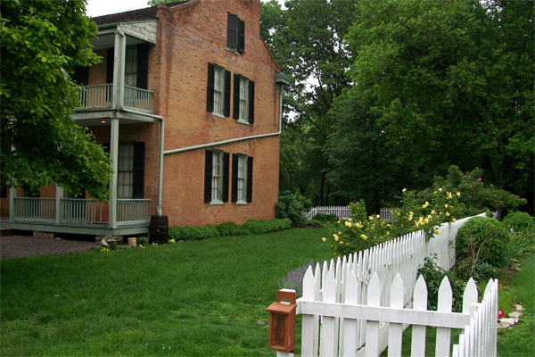
St. Louis Housing Authority
Exterior Renovation & Modernization Tiffany Apartments – Complete Site Renovation |
|
Click photo to enlarge |
CLIENT
St. Louis Housing Authority
LOCATION
St. Louis, MO
DATES OF SERVICE
August 2011 |
Pangea Engineering and Surveying, LLC, as a sub-consultant to Sherman Carter Barnhart, is responsible for providing property and topographic surveys of the areas in need of improvements and civil engineering design of the complete site renovation including parking, sidewalks, accessible ramps, fencing, retaining walls, improved site grading, stormwater collection system & rain garden for stormwater runoff water quality.
back to top |
|
| MSD CC-17 Four Season Branch Sanitary Relief Phase II |
|

Click photo to enlarge |
CLIENT
MSD
LOCATION
Chesterfield, MO |
Pangea Engineering and Surveying, LLC as the prime consultant is performing surveying and civil engineering design services to provide Topographic, property Strip Map, and Easement Preparation Surveying Services for the Providence Place Sanitary Relief Project (MSD 10549), located within the City of Chesterfield, St. Louis County and with an approximate length of 3300-feet. Pangea established horizontal and vertical control monuments over the entire length of this project, extended secondary control into the areas as needed for additional survey. The Pangea project Team is performing the Civil Engineering Design for this complicated sanitary relief project. This project requires detailed coordination with USACE for the impact to existing wetlands and floodplain, as well as coordination with each of the local utility companies for work adjacent to existing utility lines, and coordination with St. Louis County and the local neighborhood association for construction of the proposed sanitary relief sewer in the public rights-of-way and private streets, respectively.
back to top |
|
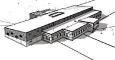
St. Louis County
Emergency Communications Center Ohlendorf Park West
|
|
Click photo to enlarge |
CLIENT
St. Louis County
LOCATION
Emergency Communications Center Ohlendorf Park West |
Pangea Engineering and Surveying, LLC as subconsultant to Ross & Baruzzini is employed to provide Topographic Surveying and Civil Engineering Design services for the development of a new 30,000-square foot facility to house the St. Louis County 911 Dispatch and the Emergency Communications Center on a 10- acre portion of Ohlendorf park West in west St. Louis County, Pangea established horizontal and vertical control monuments around the project area and provided a detailed topographic survey of the entire park area.
back to top |
|
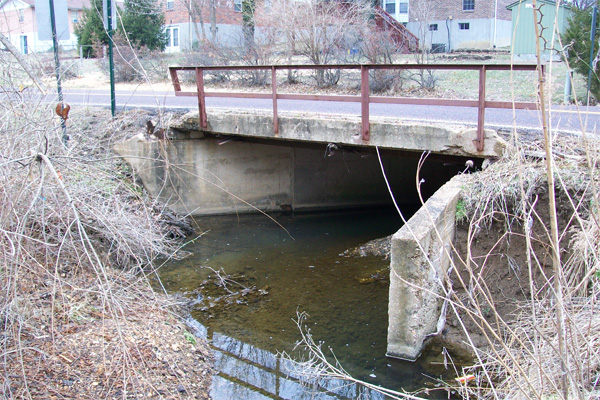
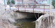
| Jefferson County - Old Antonia Bridge Replacement |
|
Click photo to enlarge |
LOCATION
Antonia, Missouri
|
Pangea Engineering and Surveying, LLC, as a subconsultant to Burns & McDonnell, on this important Jefferson County Bridge replacement project, provided property & topographic surveys.
Pangea Engineering and Surveying performed the following:
- Established project horizontal and vertical control monuments
- Topographic surveys
- Right-of-Way / Property surveys along the roadway and adjacent subdivisions and properties.
back to top |
|
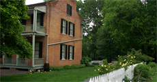
| City of Clayton – The Historic Martin Franklin Hanley House |
|
Click photo to enlarge |
LOCATION
Clayton, Missouri
|
Pangea Engineering and Surveying, LLC as a subcontractor to Planning Design Studio was employed to provide Topographic, and Property Boundary Surveying Services for proposed parking, accessibility and accommodations improvements planned for this 1-acre historic museum and park setting in the heart of the City of Clayton. Pangea established horizontal and vertical control monuments around the project area and provided detailed topographic survey of the entire park area.
back to top |
|
| Wise and Mabel Sewer Separation |
|

Click photo to enlarge |
OWNER
St. Louis Metropolitan Sewer District (MSD)
LOCATION
St. Louis, Missouri
|
Pangea Engineering and Surveying, LLC, as a subconsultant to Burns & McDonnell, is employed to provide Topographic, Strip Map, and Easement Preparation Surveying Services for the this large urban sewer separation project located within the City of Richmond Heights. Pangea established horizontal and vertical control monuments over the entire area of this project, extended secondary control into the congested areas of project in backyards and behind buildings & structures in order to complete the survey along this project consisting of approximately 10,300 feet of storm and sanitary sewer improvements. Pangea is preparing overall Property Strip Map in accordance with MSD criteria for the project and presently assigned 88 parcels requiring Easement Exhibits for the obtaining of new permanent and temporary construction license easements.
back to top |
|
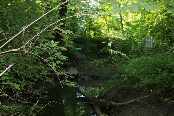
MSD Fawnvalley Storm Channel Improvements
Topographic & Strip Map Surveying and Easement Preparation |
|

Click photo to enlarge |
OWNER
St. Louis Metropolitan Sewer District (MSD)
LOCATION
St. Louis, Missouri
YEAR COMPLETED
July 2009 |
Pangea Engineering and Surveying, LLC as a Subcontractor to Stantec Consulting Services, Inc. was employed to provide Topographic, Strip Map, and Easement Preparation Surveying Services for the Fawnvalley Storm Channel Improvement Project (MSD 2006192), located within the City of Des Peres, Missouri. Pangea established horizontal and vertical control monuments over the entire length of this project, extended secondary control into the areas needed for survey. Provided detailed topographic survey of the creek and congested residential areas, while being visibly limited due to dense landscaping, over-grown wooded areas, fences, homes and other existing improvements. Pangea prepared an overall Property Strip Map in accordance with MSD criteria for the project.
back to top |
|
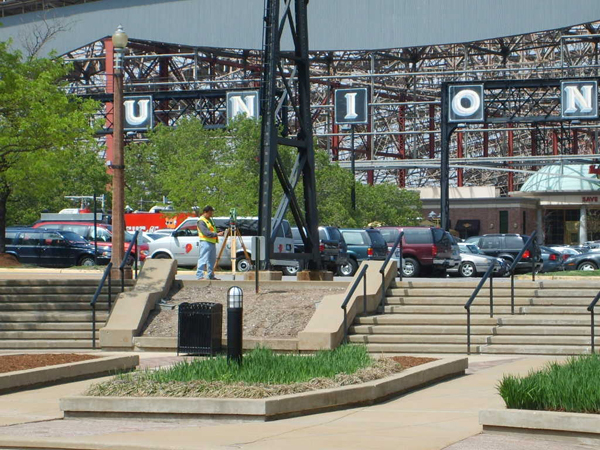
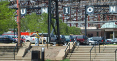
35-Acre Union Pacific Property in City Block 3417
ALTA/ASCM Land Title Survey |
|
Click photo to enlarge |
CLIENT
Greenstreet Properties
LOCATION
St. Louis, Missouri
YEAR COMPLETED
October 2008 |
Pangea Engineering and Surveying, LLC was employed by Greenstreet Properties to provide a property and topographic survey in accordance with the 2005 Minimum Standard Detail Requirements for ALTA/ACSM Land Title Surveys for the three parcels that make up the 35-acre tract of ground to be used for a 2,000,000 square foot private warehouse and distribution facility in the City of St. Louis. With difficult access to portions of the site and the unique situation of having been used as a rail yard for the entirety of its developed life, this site offered numerous complex hurdles to the field surveyors and the necessary research that was required for this project.
back to top |
|
Powerhouse and Grand Central Parcels of St. Louis Union Station
ALTA/ASCM Land Title Survey |
|
Click photo to enlarge |
CLIENT
Polsinelli Shalton Flanigan Suelthaus, PC
LOCATION
St. Louis, Missouri
YEAR COMPLETED
2008 |
Pangea Engineering and Surveying, LLC was employed by the firm of Polsinelli Shalton Flanigan Suelthaus, PC to provide a property and topographic survey in accordance with the 2005 Minimum Standard Detail Requirements for ALTA/ACSM Land Title Surveys for the Powerhouse and Grand Central out-parcels at the St. Louis Union Station development complex. In addition to the standard easements, property and topographic items that needed to be addressed, there were cross-access and parking agreements for the entire development that were addressed, and aerial easements and encroachments into the aerial easements that required special surveying attention for this detailed, complex site.
back to top |
|
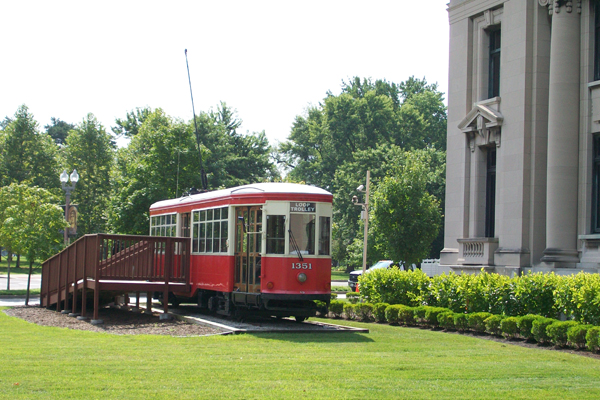
St. Louis Loop Trolley Project
Property/Right-of-Way and Topographic Surveying |
|

Click photo to enlarge |
CLIENT
St. Louis Loop Trolley Advisory Committee
LOCATION
Delmar Loop Area - St. Louis, Missouri
YEAR COMPLETED
April 2009 |
As a subconsultant to CH2M HILL, Pangea Engineering and Surveying, LLC, provided property right-of-way and topographic surveys for the proposed development of a new Street/Trolley Car project from the Lions Gates at the west end of the Delmar Loop area in University City, east along Delmar Boulevard to De Baliviere Avenue and then south along De Baliviere Avenue into Forest Park and around the St. Louis History Museum. This 2-mile long project required detailed research and surveys of existing utility systems, within University City and the City of St. Louis in order to help facilitate the design of the proposed Trolley improvements. Pangea Engineering and Surveying established project horizontal and vertical control monuments, provided full topographic surveys and surveyed existing property monumentation throughout the length of this project to establish existing right-of-way lines for streets & alleys and METRO.
back to top |
|
City of Kirkwood – Farmers Market Park / Greenway
Property/Right-of-Way and Topographic Surveying Services for Sidewalk, Planting, Grading and Drainage Improvements |
|

Click photo to enlarge |
OWNER
City of Kirkwood, Missouri
LOCATION
Kirkwood, Missouri
YEAR COMPLETED
April 2010 |
Pangea Engineering and Surveying, LLC as a Subcontractor to Planning Design Studio was employed to provide Topographic, property/right-of-way Surveying Services for sidewalk, planting, grading and drainage improvements to the ½-acre park area adjacent to the Kirkwood Farmers Market, located within the heart of the City of Kirkwood. Pangea established horizontal and vertical control monuments around the project area and provided detailed topographic survey of the entire park area.
back to top |
We are ready to support your next project with proven solutions.
Call 866-726-4320 or pangea@pangea-group.com
|
• Civil Engineering
• Structural Engineering
• Land Surveying
• Construction Surveying
We have continually expanded our areas of expertise to meet the growing needs of our clients, including the ability to address environmental controls and government regulations. Pangea has the staff and resources in house to handle every phase of a project - from design concept to construction completion.
MICHAEL
ZAMBRANA
PRESIDENT & CEO OF PANGEA GROUP
|